Back
Climate, Environment, & Biodiversity
Koordinat.ai

Protecting Denmark's nature with satellite and artificial intelligence

December 18, 2025
Credits: Koordinat.ai

Imagine if Denmark's environmental authorities could see every protected meadow, bog, and lake from space and receive automatic alerts whenever something changes. Not annually. Not every five years. In real-time.

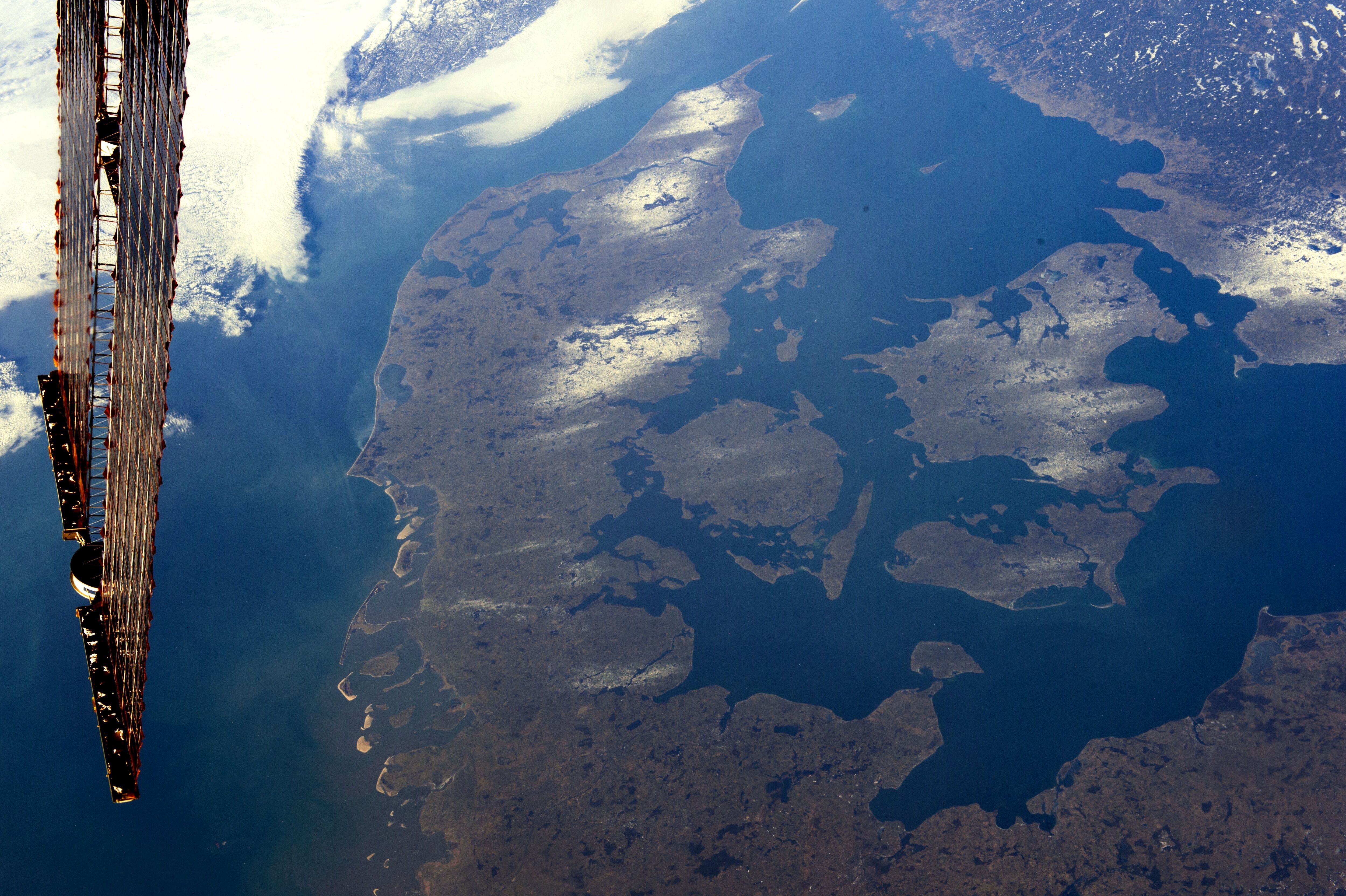
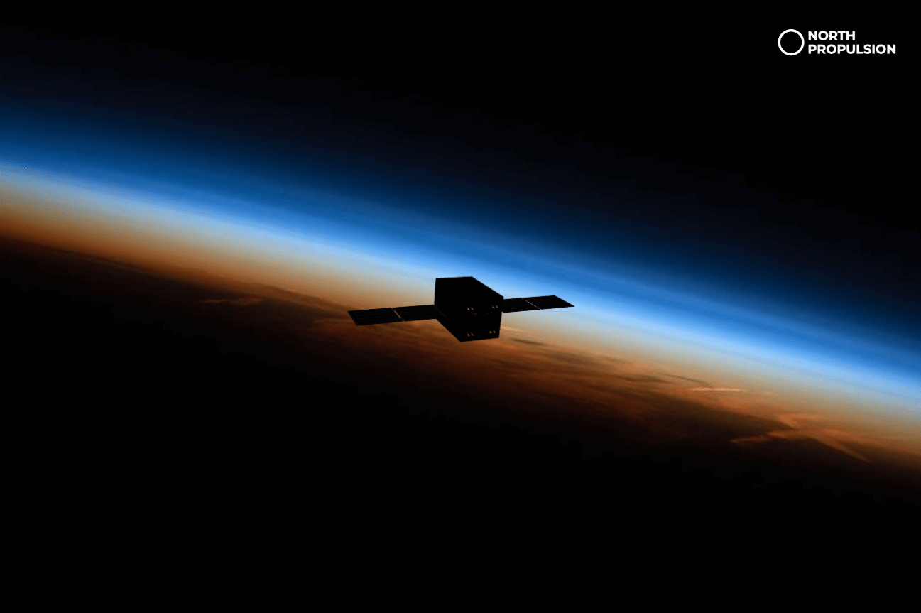
This is no longer science fiction. Koordinat.ai is making it reality by combining Earth observation data from ESA's Copernicus Sentinel satellites with artificial intelligence to revolutionize how Denmark monitors and protects Section 3 nature areas, the legally protected habitats that define 10% of the Danish landscape.

Denmark's Hidden Biodiversity Crisis: The Gap Between Law and Reality

Denmark has established a comprehensive legal framework for nature protection. Section 3 of the Danish Nature Conservation Act designates specific as legally protected. Together, these areas cover roughly 10% of Denmark's land surface, representing critical biodiversity refuges in an otherwise heavily managed agricultural landscape.

However, legal designation is not the same as actual protection. Danish municipalities are responsible for monitoring Section 3 areas, but the traditional approach has remained largely unchanged for decades: periodic field surveys, manual mapping, and infrequent updates. Many protected areas are assessed only every 5-10 years, if they are assessed at all.

This temporal lag creates a critical blind spot. Biodiversity loss, land use change, and habitat degradation happen continuously. Agricultural intensification accelerates year to year. Drainage systems are installed. Climate change alters growing conditions. By the time authorities conduct the next field survey, significant changes may have already occurred, often irreversibly.

Meanwhile, municipalities lack resources to increase survey frequency. Field teams are expensive. Expertise in habitat classification is specialized and scarce. Managing multiple survey methodologies across hundreds of hectares creates inconsistency. And fundamentally, even intensive ground surveys cannot provide the comprehensive coverage that 10% of the nation's land surface demands.

Without timely, accurate data, several consequences follow. Landowners face uncertainty about which regulations apply to their property. Authorities struggle to enforce protections: how can they enforce something they haven't recently verified still exists? Conflicts arise between conservation mandates and land use. And Denmark's biodiversity commitments, enshrined in EU policy, national legislation, and international agreements, remain difficult to verify and defend.

For policymakers, the question becomes: How much Section 3 nature actually remains? Has the area expanded or contracted? Is quality improving or declining? These fundamental questions should have clear, continuous answers, but instead they remain ambiguous, updated sporadically at significant cost and effort.

Koordinat's Solution: Making Space Data Actionable

Understanding how satellite data works is one thing. Translating it into a tool that Danish municipalities can actually use is another entirely.

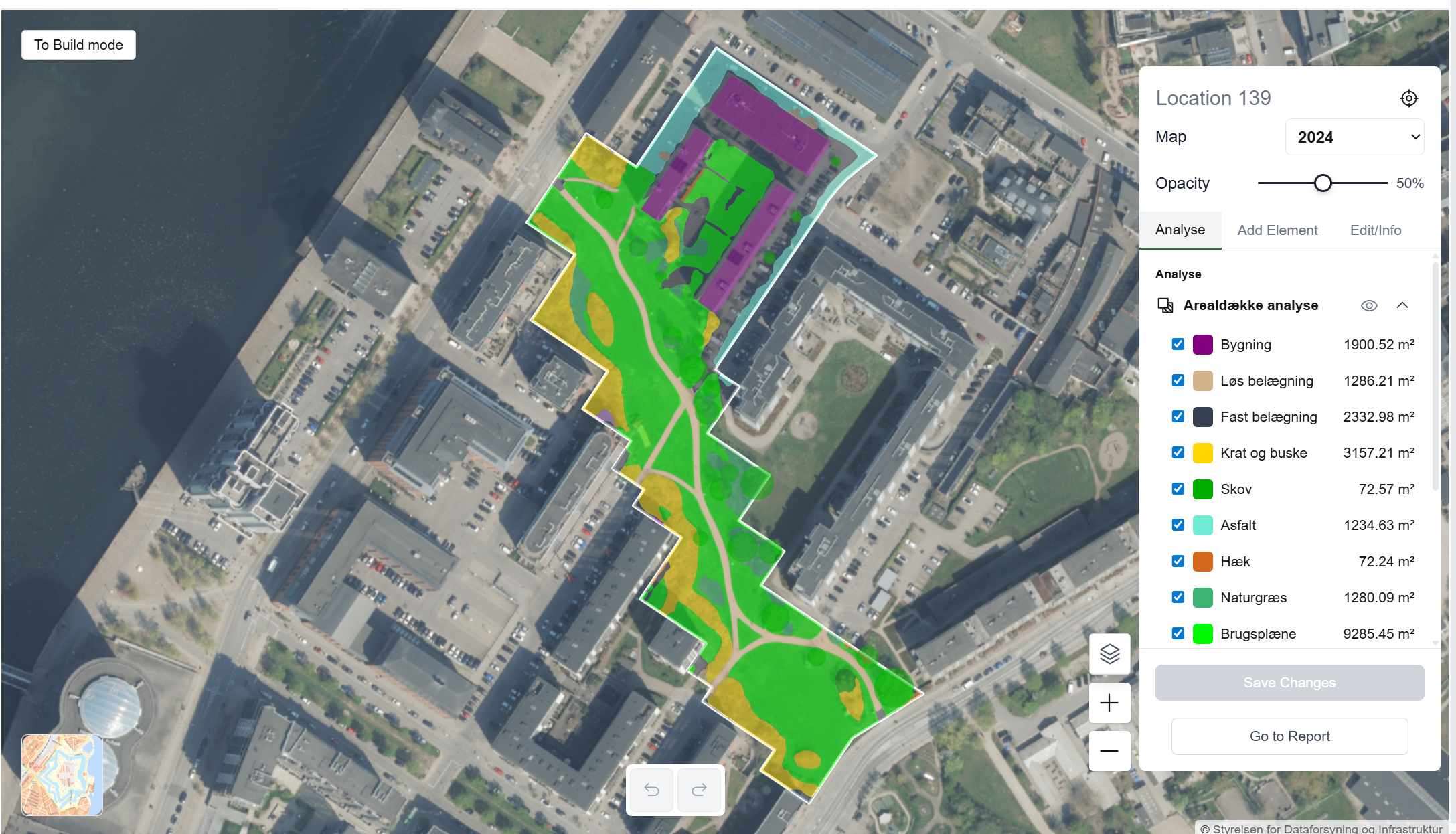
Koordinat has built a system that sits at the intersection of Earth observation, artificial intelligence, and municipal workflow integration. The core components include:

  1. Continuous satellite data ingestion: Automatically acquiring Copernicus Sentinel-2 imagery as it becomes available
  2. AI-powered classification: Running trained models to classify every pixel as a specific Section 3 habitat type or non-protected land use
  3. Change detection algorithms: Comparing temporal sequences to identify changes, their magnitude, and their significance
  4. Municipal integration: Feeding results directly into existing GIS systems that municipalities already use, ensuring minimal disruption to established workflows
  5. National database integration: Linking to Naturdatabasen, Denmark's official nature database, so data flows to regional and national levels
  6. Visualization and alerting: Presenting information in formats that case workers and decision-makers can understand and act upon

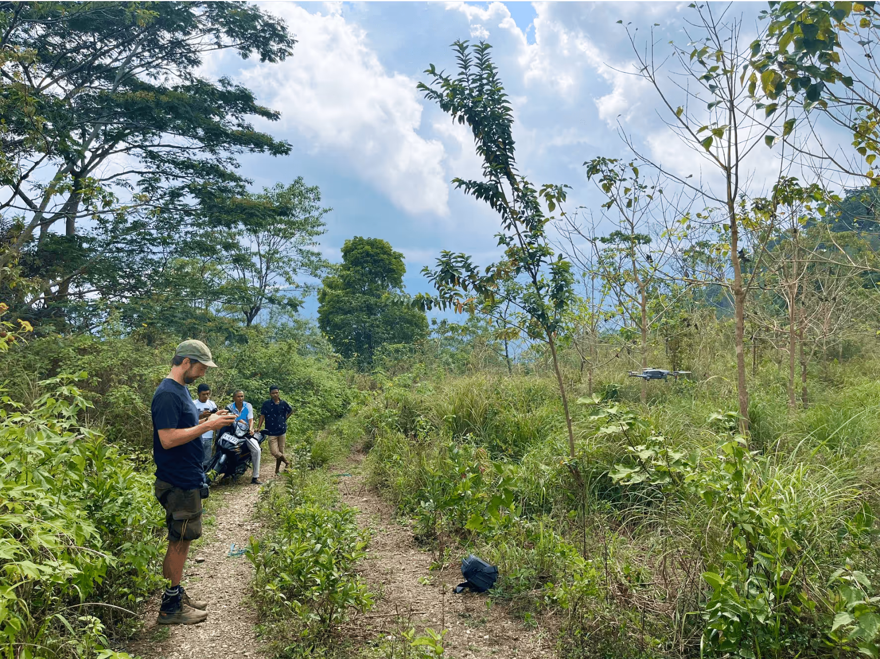
Koordinat.ai is currently being tested by five Danish municipalities:

  • Aabenraa Kommune (Southern Jutland)
  • Høje-Taastrup Kommune (Greater Copenhagen)
  • Ringsted Kommune (Zealand)
  • Roskilde Kommune (Zealand)
  • Vejle Kommune (Eastern Jutland)

These pilots span diverse geographic contexts, coastal zones, agricultural regions, urban peripheries, and peat-dominated landscapes. This geographic diversity provides essential validation that the AI models work across Denmark's varied habitats and environmental conditions.

Feedback from these pilots is informing refinement of the classification models, improvement of the integration with municipal systems, and development of additional features that case workers identify as valuable.

ESA BIC Denmark's Role: From Concept to Scale

Koordinat's journey from concept to municipal deployment is supported by ESA BIC Denmark.

What ESA BIC Denmark Provides

The program offers a comprehensive package designed specifically for startups applying space technology to real challenges:

  • €60,000 in non-equity funding - allowing the startup to invest in technology development, customer engagement, and market validation without surrendering equity or control
  • Technical expertise from ESA
  • Connections to Danish research institutions – partnerships with DTU Space, Aarhus University Space Centre (AU Space), Aalborg University Space, and University of Southern Denmark, providing research expertise and validation capabilities
  • Investor matchmaking – introduction to venture capital firms, corporate investors, and government agencies interested in climate tech and environmental solutions
  • Community and visibility – participation in events, conferences, and promotions that raise profile with potential customers and partners

Conclusion: Space Technology Serving Biodiversity

Koordinat.ai represents a profound shift in how environmental protection can work. Rather than relying on periodic, expensive, expert-intensive field surveys, protection can be grounded in continuous, objective, satellite-derived data. Rather than treating nature conservation as separate from land use management, integrated monitoring enables intelligent coexistence.

Koordinat is what becomes possible when that space infrastructure meets Danish entrepreneurship, AI expertise, and a genuine public need. As biodiversity declines globally and environmental governance becomes increasingly urgent, solutions like Koordinat offer hope.

Marta Pareja Boto
ESA BIC Student Assistant

Related articles

Manufacturing
Mobile 3D Printing for Concrete Today, Lunar Construction Tomorrow

Dec 19, 2025

Case study
Environment
Protecting Denmark's nature with satellite and artificial intelligence

Dec 18, 2025

Case study
Environment
Using Space Technology to Clean the Arctic

Dec 18, 2025

Case study
All
Strong growth in Danish space-based startups

Nov 28, 2025

Insight
All
The Future of Space-Based Startups in Europe

Aug 29, 2025

Insight
Manufacturing
ThiaX provides real-time, non-destructive X-ray mapping of strain and crystallinity in polymers and composites

Jul 24, 2025

Case study
Drones & Robotics
AI-driven off-road autonomy software for unmanned ground vehicles on the modern battlefield

Case study
AI & Big Data
Security
Securing industrial IoT through decentralized data integrity

Case study
Drones & Robotics
Smart solutions for year-round outdoor cleaning

Case study
AI & Big Data
High efficiency compression for energy IoT and space applications

Case study
Drones & Robotics
Security
Smart identification systems for drones and airspace safety

Case study
Agriculture
Geospatial and climate model integration for agricultural finance

Case study
Drones & Robotics
Autonomous operation software for agricultural machines

Case study
Healthcare
Durable chemical free biofilm protection for materials

Case study
Drones & Robotics
Electric cargo drone systems for efficient air freight

Case study
Space
Field ready handheld chemical analysis devices

Case study
Space
Human centered design for future space habitats

Case study
Space
A one-stop shop for Composite structures in Space, with in-house design, manufacturing & testing

Case study
Drones & Robotics
Secure and efficient flight management with multispectral imaging

Case study
N/A
Comprehensive performance data for horse riders and trainers

Case study
Infrastructure
Digital solutions for smart cities and communities

Case study
Healthcare
Smart medical devices for respiratory care

Drones & Robotics
Data driven market intelligence for industrial wastewate

Case study
Agriculture
Satellite enabled smart scheduling for farm management

Case study
Space
X-ray optics design and thin film coating solutions

Case study
Maritime
Drones & Robotics
Galileo enabled drone systems for maritime operations

Case study
Fintech
Fintech for liquid and sustainable forest assets

Case study
Healthcare
Assistive navigation solutions for the visually impaired

Case study
Drones & Robotics
Airborne antenna testing for global SatCom applications

Case study
Infrastructure
Smart GPS tracking for personal and business assets

Case study
Maritime
Maritime connectivity through LEO satellites

Case study
Infrastructure
Digital infrastructure for cities and municipalities

Case study
Agriculture
Early detection of crop threats through data-driven insights

Case study
Drones & Robotics
Autonomous platforms for repetitive and dangerous tasks

Case study
Agriculture
Cloud-free satellite imagery for urban and landscape monitoring

Case study
Drones & Robotics
High-end flight termination systems for safe drone operations

Case study
Maritime
Robotic solutions for maritime tasks

Case study
Agriculture
Drones & Robotics
Drone imagery analysis for crop and weed detection

Case study
Space
Non-destructive testing using terahertz lightwaves

Case study
N/A
Rapid installation of screw pile foundations

Case study
Space
Chemical Propulsion For Microsatellites

Case study
Environment
Using earth observation to guide peatland restoration

Case study
Space
Advancing space-based materials and microdevice development

Case study
Maritime
Searchlights designed for safety and rescue at sea

Case study
Education
Science experiments made simple for the classroom

Case study
Environment
Drones & Robotics
Security
Reducing wildfire impact with autonomous technology

Case study
Security
Maritime
How Danish Company Tordenskjold Uses Satellite Technology to Enhance Maritime Security

Case study
Maritime
Sensemakers is Transforming the Danish Maritime Environment Using Space

Case study
Manufacturing
From road to orbit: How AIRY’s additive manufacturing for EVs is now building lightweight structures for satellites

Case study
Infrastructure
InnoPilot Leverages Space Technology to Keep Critical Infrastructure Safe and Connected

Case study
Healthcare
How Yuman frees up nurses using robots assistants integrated with GNSS

Case study
Fintech
From Space to Shipping Markets: How Danish Company Navi Merchant Uses Satellite Data to Predict Freight Prices

Case study
Environment
How Klimate uses space to verify forest carbon dioxide removal

Case study
Energy
Aerial Tools Uses Satellite Technology to Improve Energy Efficiency and Solar Maintenance

Case study
Drones & Robotics
How using satellite data helps HectoDrone to map environmental challenges and carry out surveillance in cold isolated areas like Greenland

Case study
AI & Big Data
Using Satellite Data, Atla.ai Delivers Smarter Solutions for Precision Agriculture

Case study
Agriculture
PerPlant Uses Space Technology to Make Precision Agriculture Accessible to All Farmers

Aug 1, 2025

Case study
All
What is a space connection?

Apr 28, 2025

Insight