Back
Agriculture
GreenGuard Automation

Laser Precision for a Chemical‑Free Field

January 5, 2026
Credits: GreenGuard

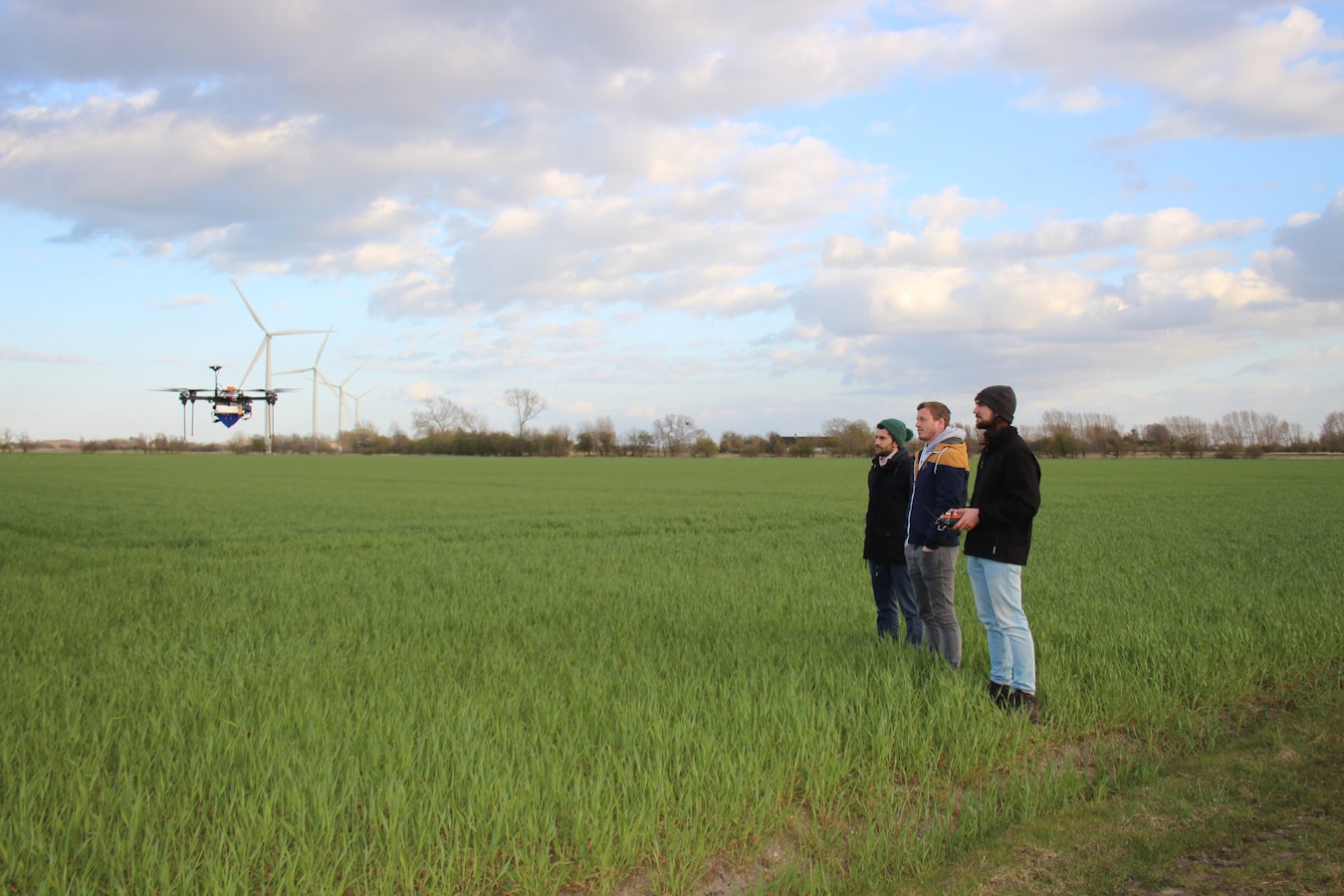
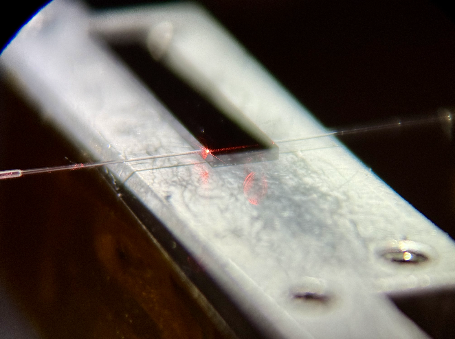
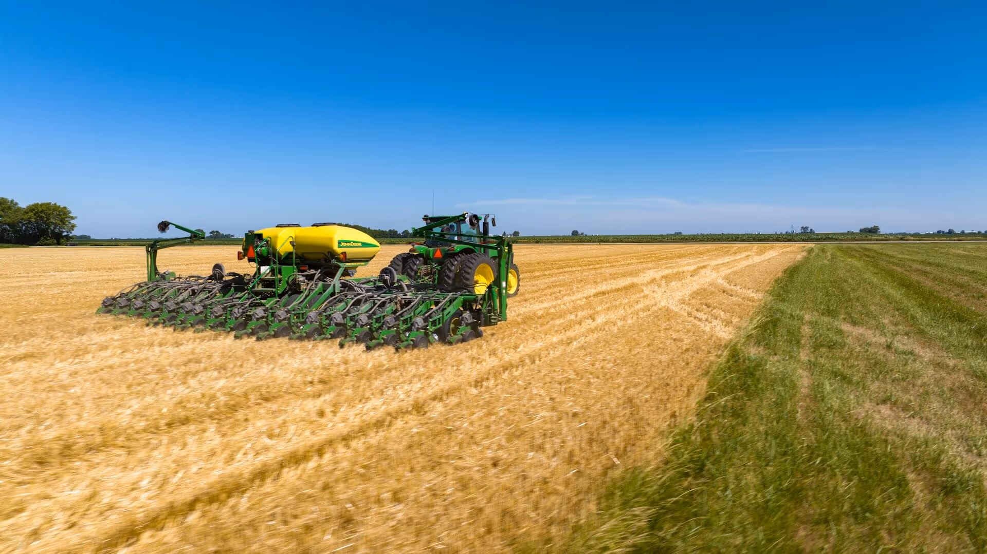
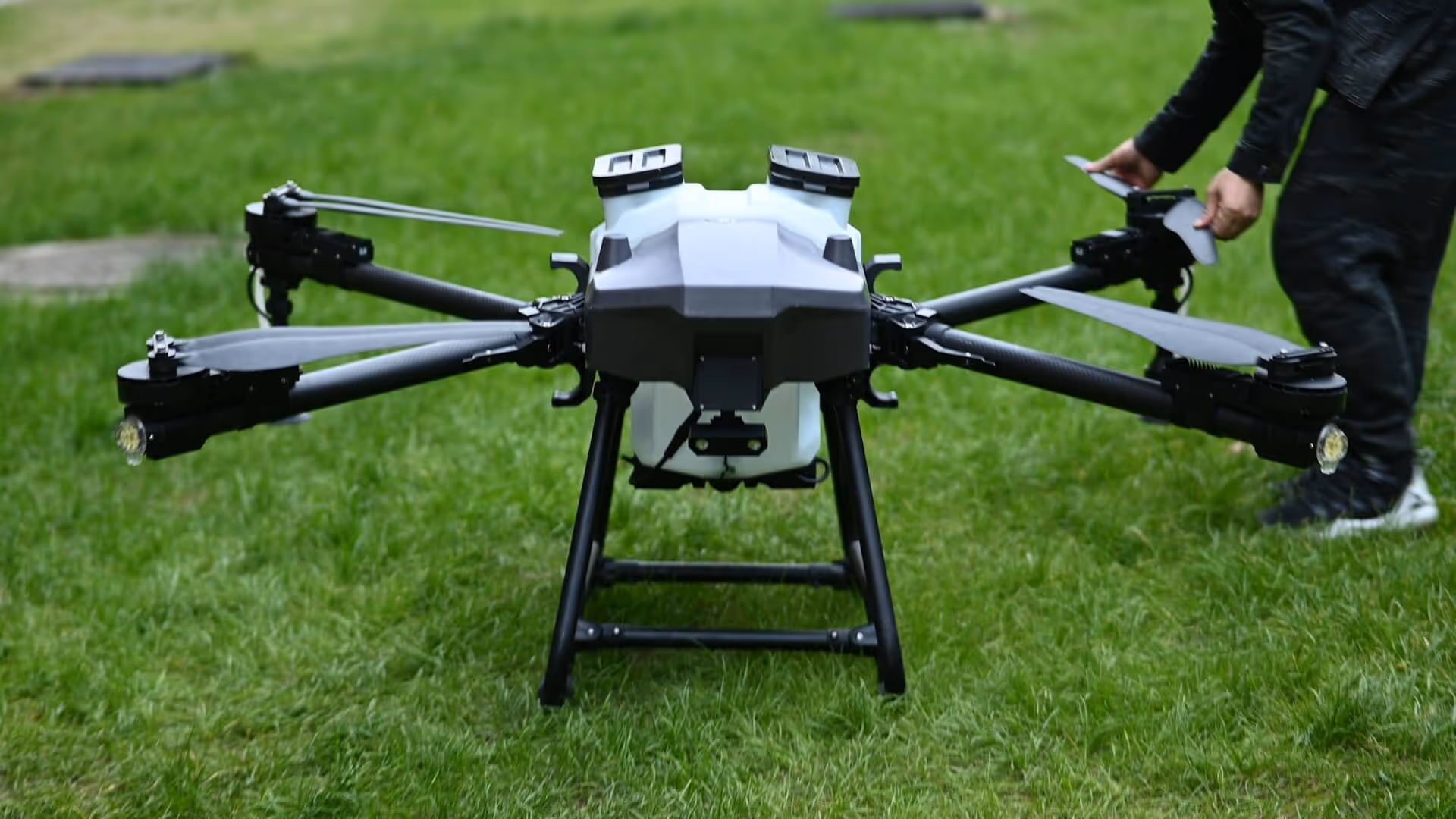
GreenGuard Automation develops a tractor‑mounted, laser‑based weed control system that uses advanced vision, robotics and satellite data to give farmers chemical‑free, precise and cost‑efficient weeding in high‑value crops.

Laser Precision for a Chemical‑Free Field

Modern agriculture stands in a difficult balance. On one side, farmers face pressure to reduce pesticide use, protect biodiversity and meet stricter environmental standards. On the other, weeds continue to cause significant yield losses and organic growers in particular spend enormous time and money on manual weeding.

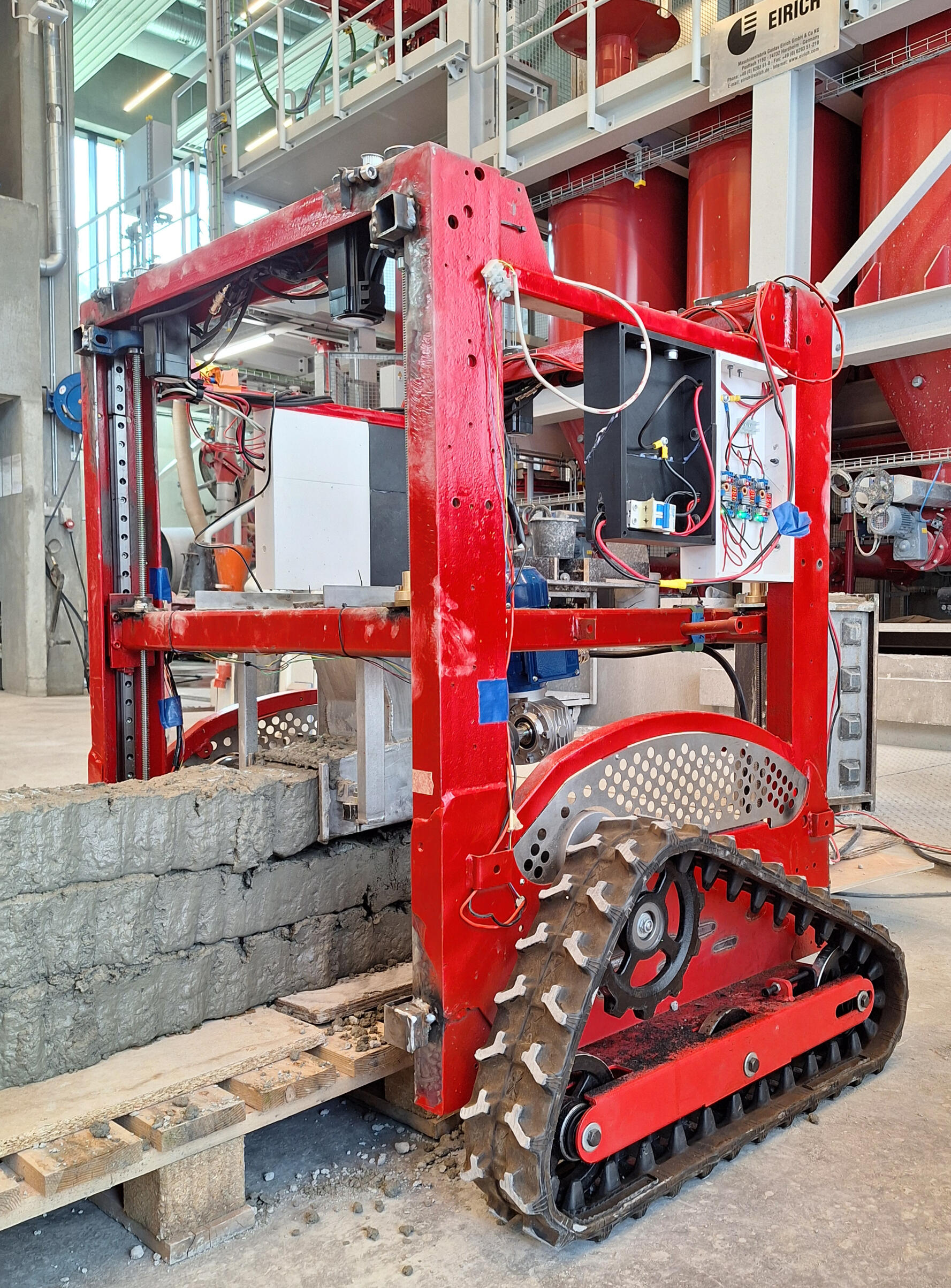
GreenGuard is building what they describe as Europe’s first tractor‑mounted laser system for weed control. Mounted on standard machinery and aimed at high‑value crops, their system is designed to recognise individual weeds in the row and neutralise them with high‑precision laser pulses instead of herbicides. The goal is simple to state but challenging to achieve: kemifri præcisionsukrudtsbekæmpelse – chemical‑free precision weed control that makes it possible for farmers to grow more sustainably and far more cost‑effectively.

How It Works: Vision, Lasers and Learning in the Field

Behind the concept sits a multidisciplinary technology stack. GreenGuard combines:

  • Advanced computer vision to detect and distinguish weeds from crops in real time.
  • High‑precision laser technology integrated on a tractor‑mounted platform to target weeds without harming neighbouring plants.
  • Self‑supervised learning in the field, so the system improves continuously as it encounters new conditions.
  • Satellite and area data for planning, helping decide where and when to deploy the system most effectively.

Instead of spraying an entire bed or sending crews into the field with hoes, the GreenGuard system looks at each plant, decides if it is crop or weed, and applies a laser pulse only where needed.

From Pilot Prototypes to Scalable Systems

GreenGuard’s development strategy is deliberately focused. The company has set itself one main goal: bring a fully functional, laser‑based weed control solution to market, and then scale it across Northern Europe.

The system is being developed as a tractor‑mounted solution rather than a standalone robot, ensuring compatibility with equipment farmers already own. That choice lowers adoption barriers and reflects a pragmatic understanding of how new technology can fit into existing operations rather than asking growers to change everything at once.

Space and Data: Planning from Above, Acting on the Ground

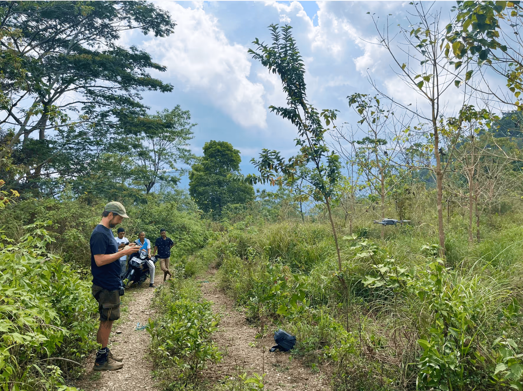
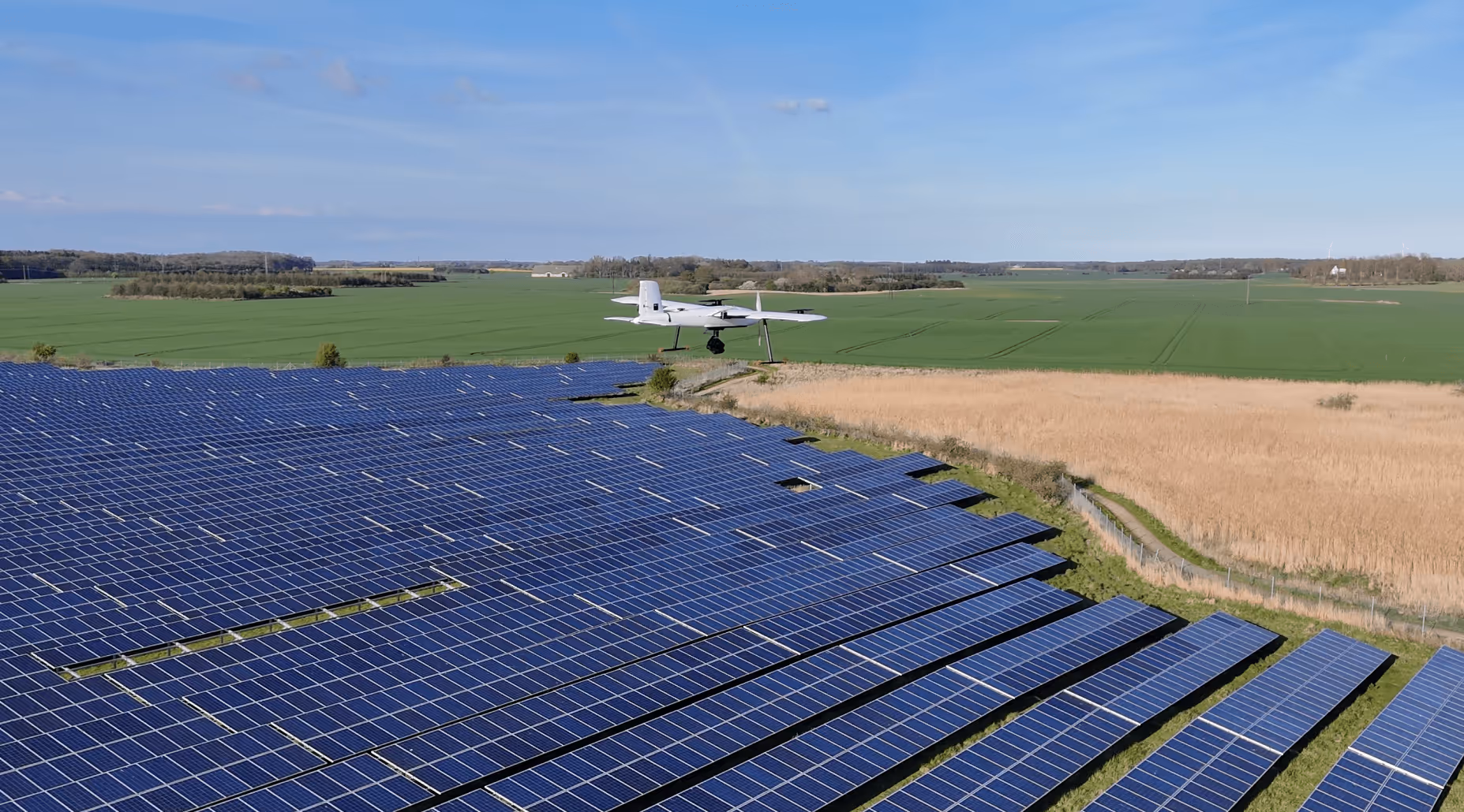
While GreenGuard’s core is very much on the ground, the company explicitly notes that it uses satellite and area data for planning. This aligns with a broader ESA BIC perspective: Earth observation and geospatial data can help agriculture plan interventions more intelligently. It helps identifying fields or zones with higher weed pressure, optimising routes and timing, and documenting the impact of interventions over time.

A Focused Mission with Broader Implications

Ultimately, GreenGuard’s mission can be summarised in one sentence: develop the next generation of chemical‑free, precise and cost‑effective weed control for high‑value crops. Behind that mission sit broader implications:

If the team succeeds, future images of sustainable farming may include more than just drones and sensors – they may show tractor‑mounted laser systems silently removing weeds, guided both by cameras centimetres above the soil and by satellite data hundreds of kilometres above the Earth.

Marta Pareja Boto
ESA BIC Student Assistant

Related articles

All
Watch it now: Information Meeting on Danish Public Funding Opportunities for Space

Jan 12, 2026

Insight
Agriculture
Laser Precision for a Chemical‑Free Field

Jan 5, 2026

Case study
Space
Bringing 5G Thinking to Low‑Earth Orbit

Dec 30, 2025

Case study
Environment
Turning Satellite Data into Biodiversity Intelligence for Cities

Dec 29, 2025

Case study
Manufacturing
Making "right pallet, right place, right truck" the rule.

Dec 23, 2025

Case study
Manufacturing
Mobile 3D Printing for Concrete Today, Lunar Construction Tomorrow

Dec 19, 2025

Case study
Environment
Protecting Denmark's nature with satellite and artificial intelligence

Dec 18, 2025

Case study
Environment
Using Space Technology to Clean the Arctic

Dec 18, 2025

Case study
All
Strong growth in Danish space-based startups

Nov 28, 2025

Insight
All
The Future of Space-Based Startups in Europe

Aug 29, 2025

Insight
Manufacturing
ThiaX provides real-time, non-destructive X-ray mapping of strain and crystallinity in polymers and composites

Jul 24, 2025

Case study
Drones & Robotics
AI-driven off-road autonomy software for unmanned ground vehicles on the modern battlefield

Case study
AI & Big Data
Security
Securing industrial IoT through decentralized data integrity

Case study
Drones & Robotics
Smart solutions for year-round outdoor cleaning

Case study
AI & Big Data
High efficiency compression for energy IoT and space applications

Case study
Drones & Robotics
Security
Smart identification systems for drones and airspace safety

Case study
Agriculture
Geospatial and climate model integration for agricultural finance

Case study
Drones & Robotics
Autonomous operation software for agricultural machines

Case study
Healthcare
Durable chemical free biofilm protection for materials

Case study
Drones & Robotics
Electric cargo drone systems for efficient air freight

Case study
Space
Field ready handheld chemical analysis devices

Case study
Space
Human centered design for future space habitats

Case study
Space
A one-stop shop for Composite structures in Space, with in-house design, manufacturing & testing

Case study
Drones & Robotics
Secure and efficient flight management with multispectral imaging

Case study
N/A
Comprehensive performance data for horse riders and trainers

Case study
Infrastructure
Digital solutions for smart cities and communities

Case study
Healthcare
Smart medical devices for respiratory care

Drones & Robotics
Data driven market intelligence for industrial wastewate

Case study
Agriculture
Satellite enabled smart scheduling for farm management

Case study
Space
X-ray optics design and thin film coating solutions

Case study
Maritime
Drones & Robotics
Galileo enabled drone systems for maritime operations

Case study
Fintech
Fintech for liquid and sustainable forest assets

Case study
Healthcare
Assistive navigation solutions for the visually impaired

Case study
Drones & Robotics
Airborne antenna testing for global SatCom applications

Case study
Infrastructure
Smart GPS tracking for personal and business assets

Case study
Maritime
Maritime connectivity through LEO satellites

Case study
Infrastructure
Digital infrastructure for cities and municipalities

Case study
Agriculture
Early detection of crop threats through data-driven insights

Case study
Drones & Robotics
Autonomous platforms for repetitive and dangerous tasks

Case study
Agriculture
Cloud-free satellite imagery for urban and landscape monitoring

Case study
Drones & Robotics
High-end flight termination systems for safe drone operations

Case study
Maritime
Robotic solutions for maritime tasks

Case study
Agriculture
Drones & Robotics
Drone imagery analysis for crop and weed detection

Case study
Space
Non-destructive testing using terahertz lightwaves

Case study
N/A
Rapid installation of screw pile foundations

Case study
Space
Chemical Propulsion For Microsatellites

Case study
Environment
Using earth observation to guide peatland restoration

Case study
Space
Advancing space-based materials and microdevice development

Case study
Maritime
Searchlights designed for safety and rescue at sea

Case study
Education
Science experiments made simple for the classroom

Case study
Environment
Drones & Robotics
Security
Reducing wildfire impact with autonomous technology

Case study
Security
Maritime
How Danish Company Tordenskjold Uses Satellite Technology to Enhance Maritime Security

Case study
Maritime
Sensemakers is Transforming the Danish Maritime Environment Using Space

Case study
Manufacturing
From road to orbit: How AIRY’s additive manufacturing for EVs is now building lightweight structures for satellites

Case study
Infrastructure
InnoPilot Leverages Space Technology to Keep Critical Infrastructure Safe and Connected

Case study
Healthcare
How Yuman frees up nurses using robots assistants integrated with GNSS

Case study
Fintech
From Space to Shipping Markets: How Danish Company Navi Merchant Uses Satellite Data to Predict Freight Prices

Case study
Environment
How Klimate uses space to verify forest carbon dioxide removal

Case study
Energy
Aerial Tools Uses Satellite Technology to Improve Energy Efficiency and Solar Maintenance

Case study
Drones & Robotics
How using satellite data helps HectoDrone to map environmental challenges and carry out surveillance in cold isolated areas like Greenland

Case study
AI & Big Data
Atla.ai Turns Satellite Data into Actionable Insights with AI

Case study
Agriculture
PerPlant Uses Space Technology to Make Precision Agriculture Accessible to All Farmers

Aug 1, 2025

Case study
All
What is a space connection?

Apr 28, 2025

Insight